| ||||||
| ||||||
LKKL - AIP CZ
Aerodrome chart
WEBCAM
Visual approach chart
|
How to get there:The club field is situated approximately 4 km southwest of the city of Kladno. The airfield can be reached by car directly from the center of the town, by taking the exit to Beroun. Alternatively, take the exit "Velká Dobrá" from the highway Praha - Karlovy Vary (Carlsbad). In the small town of "Velká Dobrá", turn right, and then left on the next intersection. After 300 m, a right turn will take you right to the club gate. The airfield of Kladno - arrival map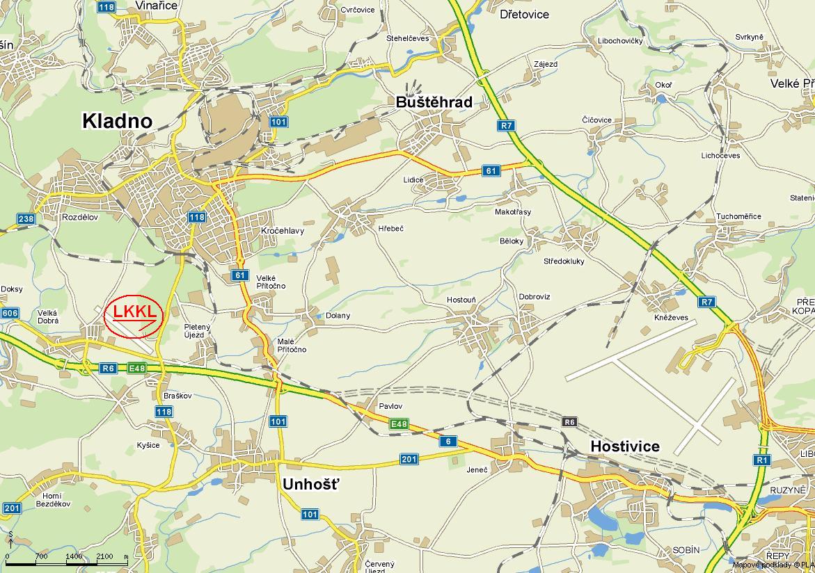
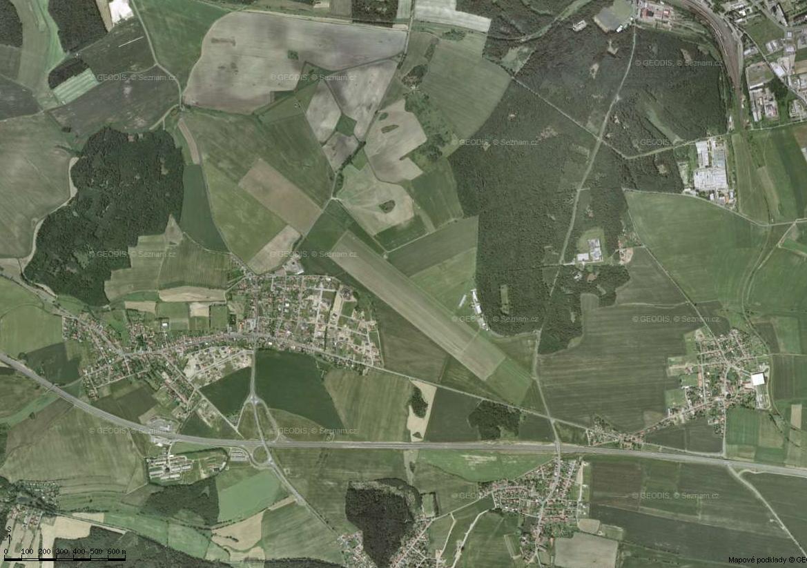
GPS: 50o06´46" N 014o05´23" E ; ALTITUDE: 433m ; FREKVENCE: 123,475 ; KLADNO INFO 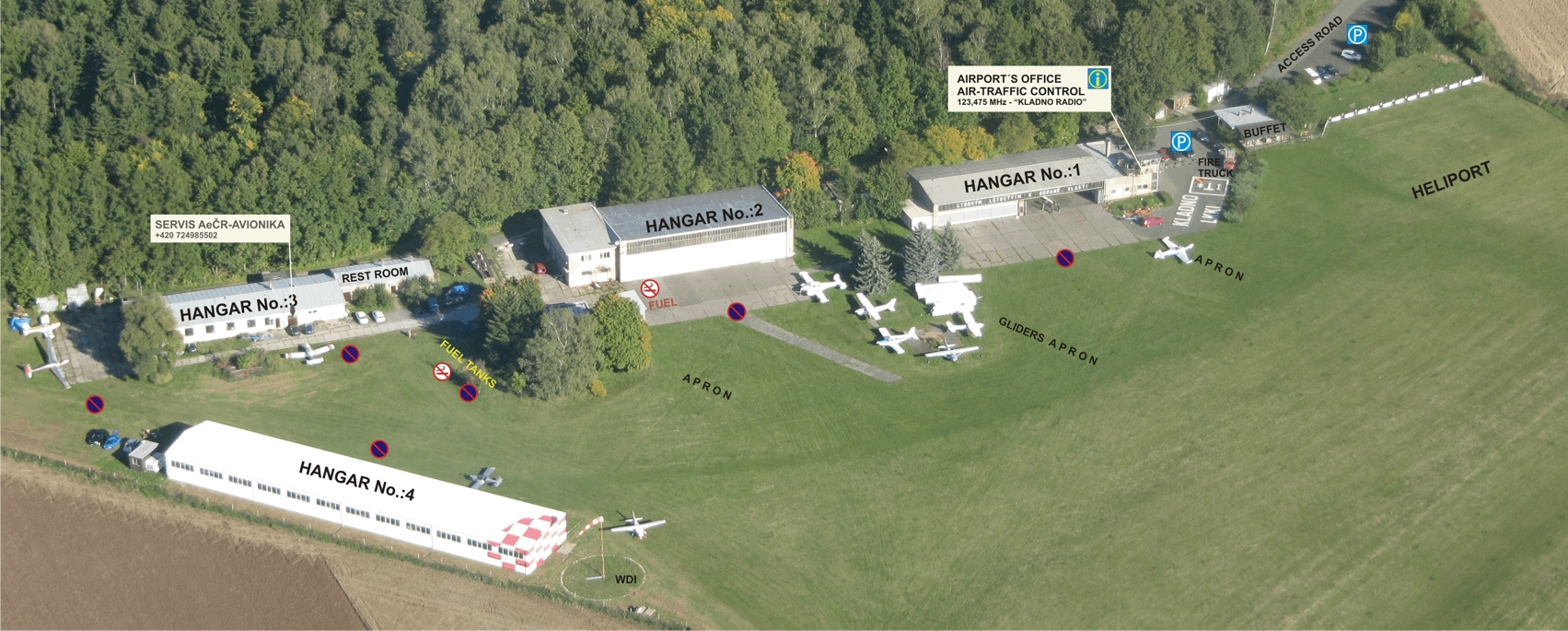
| |||||
|
Aeroklub Kladno© | ||||||


